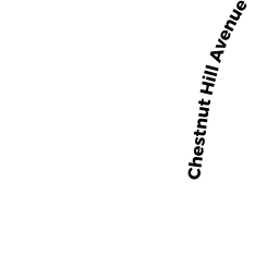
678 CHESTNUT HILL AV
Owner Information
WILLEY MARILYN E LIFE ESTATE ET-AL
678 CHESTNUT HILL AV
ATHOL, MA 01331


Property Details
678 CHESTNUT HILL AV is classified as a Single Family Residential (Conventional).
The primary structure on this property was built in 1910. There are 5,541ft2 of built area within this property. There is 2,887ft2 of residential/living space within this property. This property is listed as having 9 rooms.
678 CHESTNUT HILL AV is valued at $268,200. The land is valued at $57,900 and the structures are valued at $203,700. There is an additional valuation of $6,600 on this property.
This property is in Zone RB. Confirm with local Zoning Board authorities to ensure there are no overlays or other easements on this property.
The most recent deed for 678 CHESTNUT HILL AV is recorded at the local registrar in Book 42959, Page 0114. 678 CHESTNUT HILL AV was last sold on Thursday, June 12, 2008 for $1.
Assessment data from fiscal year 2022.
Flood Data
According to the FEMA National Flood Hazard Layer, this property does not appear to be in a flood zone. It may also be in an area not yet reviewed. Nonetheless, confirm this information prior to taking any action.
To view the flood hazards around this property, create a FEMA "Firmette" Map of the area around 678 CHESTNUT HILL AV.
Broadband Internet Providers
| Provider | Type | Bandwidth (mbps) | |
|---|---|---|---|
| Comcast | Cable | 1000 | 35 |
| GCI Communication Corp. | Satellite | 0 | 0 |
| Verizon New England Inc. | DSL | 15 | 1 |
| VSAT Systems, LLC. | Satellite | 2 | 1 |
| HughesNet | Satellite | 25 | 3 |
| Charter Communications Inc | Cable | 940 | 35 |
| Viasat Inc | Satellite | 100 | 3 |
Broadband service provider data from December 2020.
Adjacent Properties
- OLD KEENE RD
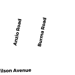
Undevelopable Residential Land owned by TOTMAN HERBERT L - 97 BURMA RD
Single Family Residential owned by ADAMETZ KIMBERLY - 83 BURMA RD
Single Family Residential owned by LAPOINTE SHAUN M - 67 BURMA RD
Single Family Residential owned by WILLIAMS CONSTANCE E - 51 BURMA RD
Single Family Residential owned by PATRIQUIN GERALD R JR - 37 BURMA RD
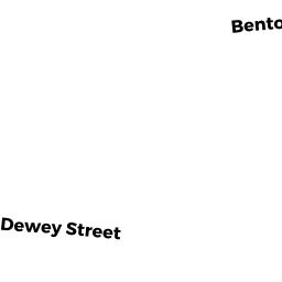
Single Family Residential owned by TALBOT MELVIN L JR - 12 DEWEY ST
Accessory Land with Improvement owned by GUNDEL JONATHAN - DEWEY ST
Developable Residential Land owned by WILLEY MARILYN E LIFE ESTATE - 40 DEWEY ST
Single Family Residential owned by ROBICHAUD JENNIFER E - 60 DEWEY ST
Single Family Residential owned by ALLEN CARRIE E - 622 CHESTNUT HILL AV
Single Family Residential owned by NOLAN DANIEL J - 648 CHESTNUT HILL AV
Single Family Residential owned by MUNDELL DONALD E - 4 OLD KEENE RD
Single Family Residential owned by SAWIN, ERIC L